The River That Made History
The Chestatee River didn’t just witness American history — it was the site where American history was made.
In 1828–29, a gold discovery in the hills above the Chestatee River triggered the first major gold rush in American history — the rush took hold in 1829, 20 years before the California rush that history textbooks remember far better (New Georgia Encyclopedia). The river that Cherokee people had named, fished, and depended on for centuries became the epicenter of a continental scramble for gold that reshaped North Georgia permanently. Why some sources say 1828 and others 1829 is covered in the disputed start of the rush.
This is the story of the Chestatee River — from its origins as Cherokee homeland to America’s forgotten first gold rush.
The Cherokee: Original People of the Chestatee
Before Europeans arrived, the Chestatee River was the heart of Cherokee country in what is now North Georgia.
The name “Chestatee” itself comes from the Cherokee language. The most widely accepted translation is “place of the lights” or “torch place” — possibly referring to pine torches used for night fishing, or a reference to fires along the river. The exact meaning is debated among linguists, but the name has endured for centuries, outlasting the colonial effort to rename everything in the American South.
For the Cherokee people, the river was not a boundary or a resource to be extracted — it was integral to their culture, sustenance, and spiritual life. The Chestatee watershed supported villages, hunting grounds, and travel corridors through the Appalachian highlands.
Cherokee Towns Along the Chestatee
Several Cherokee towns existed in the Chestatee watershed, including Ahasi (associated with the Chestatee area) and communities connected to the larger Cherokee settlements at New Echota (the Cherokee capital, located further south near present-day Calhoun, Georgia).
The Cherokee were not primitive forest dwellers — by the early 1800s, Cherokee society had developed a written language (Sequoyah’s syllabary, 1821), a constitutional government, printing presses publishing the Cherokee Phoenix newspaper, and substantial agricultural operations. The Chestatee valley held farms, orchards, and roads.
The Trail Where They Cried
In 1838, the United States Army forcibly removed the Cherokee people from their Georgia homeland in what became known as the Trail of Tears — Nunna daul Tsuny in Cherokee, “the trail where they cried.”
Approximately 16,000 Cherokee were marched westward to present-day Oklahoma. An estimated 4,000 died from disease, exposure, and starvation during the removal. The Chestatee valley, along with all of North Georgia, was cleared of its original inhabitants within months.
The river kept their name. The land was opened for settlement — and the gold rush that had partly motivated the removal accelerated immediately after.
1829: America’s First Major Gold Rush
On a property in present-day Lumpkin County, approximately three miles from Dahlonega, gold was discovered in 1828. The exact story of the first discovery has multiple versions — the most credible accounts point to a man named Benjamin Parks tripping over a yellow rock near Lick Log Creek (a Chestatee tributary) in the autumn of 1828.
What happened next was immediate and overwhelming. Word spread. Prospectors poured into North Georgia from across the Eastern seaboard. Within months, the mountain valleys of the Chestatee watershed were crowded with mining operations ranging from individual panners to organized hydraulic mining enterprises.
The Scale of the Rush
At its peak in the early 1830s, it’s estimated that 10,000 people were working gold claims in the North Georgia mountains — a population that dwarfed the handful of Cherokee families and pioneer settlers who had previously occupied the region.
The Georgia Gold Rush was the largest gold rush in American history up to that point. It predated the 1849 California rush by more than two decades. Yet the California rush, which followed the Mexican-American War and opened the Pacific to American settlers, captured the national mythology.
North Georgia’s gold rush — which displaced a sovereign Cherokee nation and helped finance the forced removal — occupies a more complicated place in American memory.
Dahlonega: The Boomtown
The town of Dahlonega (pronounced dah-LON-eh-gah) grew directly from the gold rush. Its name is derived from the Cherokee word dahlonege, meaning “yellow money” or simply “gold.”
By 1833, Dahlonega was the seat of Lumpkin County, with a courthouse, hotels, and newspapers. It was one of the fastest-growing towns in the South.
The U.S. Branch Mint at Dahlonega
In 1835, the United States Congress authorized a branch mint in Dahlonega — recognition of the scale of gold production in the North Georgia mountains. The Dahlonega Branch Mint opened in 1838 and operated until 1861.
During its 23 years of operation, the Dahlonega Mint coined more than 1.3 million gold coins totaling over $6 million in face value, produced coins in denominations of $1, $2.50, $3, and $5, processed gold drawn from dozens of mines throughout the Chestatee watershed, and employed 30–40 workers at peak production.
Coins minted in Dahlonega are identifiable by the “D” mint mark — though that same mark was later used by the Denver Mint (established 1906), which has caused occasional confusion for coin collectors.
The Dahlonega Mint closed in 1861 when Georgia seceded from the Union and Confederate forces took possession of the building. It was later used as a college and eventually destroyed by fire in 1878.
Today: The site of the original mint is now occupied by Price Memorial Hall on the campus of the University of North Georgia in Dahlonega. The distinctive gold-leaf tower is a visible landmark in the town square.
Mining Methods Along the Chestatee
The gold mining that defined the Chestatee watershed in the 19th century employed several techniques, each leaving marks on the landscape that are still visible to careful observers.
Placer Mining (Panning and Sluicing)
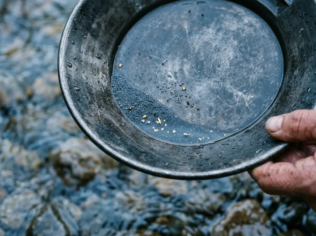
The simplest method: washing river gravel through a pan to separate heavy gold from lighter sediment. The Chestatee and its tributaries were placer-mined intensively. Gravel bars were redirected, stream channels diverted, and acres of river bottom turned over in the search for gold.
Hydraulic Mining
Later, more intensive operations used pressurized water to blast hillsides and wash entire slopes through sluice boxes. Hydraulic mining scars — concave, eroded cliff faces — are still visible in parts of the Chestatee watershed more than 150 years after mining ended.
Hard Rock (Lode) Mining
As surface placer deposits were exhausted, miners followed gold veins into bedrock. The Dahlonega area has more than a dozen documented mine shafts from the 19th century. Several were reopened briefly in the 20th century.
The 20th Century: From Mining to Mountain Living
The gold rush era effectively ended by the 1880s — the easily accessible gold was gone, labor costs rose, and the introduction of cyanide processing in western mines made Georgia’s operations economically marginal.
The region transitioned to timber, agriculture, and eventually tourism. The University of North Georgia (originally North Georgia College) established in 1873, became the anchor institution for Dahlonega’s revival as a college town.
The construction of Lake Sidney Lanier in the 1950s — formed by damming the Chattahoochee, into which the Chestatee flows — brought massive recreational development to the downstream watershed. The Chestatee’s lower miles were flooded as the lake rose.
Today, the upper and middle Chestatee runs free and largely undeveloped — managed by Georgia DNR as exceptional trout habitat, paddled by kayakers, and fished by anglers who understand what “wild trout water” means.
The Chestatee Today
The river endures. The gold rush towns are gone. The Cherokee homelands are occupied by mountain farms and vacation cabins. The Dahlonega Mint is a university building.
But the Chestatee flows on — cold, clear, and wild — carrying the runoff of the same mountains that hid the gold that changed American history.
For residents of the Chestatee valley, this history isn’t distant. It’s in the streambed gravel. It’s in the name of the river. It’s in the gold-domed county courthouse on the Dahlonega square, a city founded on a river.
Visit the History
Dahlonega Gold Museum — 1 Public Square, Dahlonega, GA. Located in the original Lumpkin County courthouse (1836), the museum houses gold rush artifacts, original coins from the Dahlonega Mint, and exhibits on Cherokee history. One of the finest small history museums in Georgia.
Consolidated Gold Mines — 185 Consolidated Gold Mine Rd, Dahlonega, GA. Underground mine tours of authentic 19th-century hard rock mine tunnels. Gold panning available on-site.
University of North Georgia, Dahlonega Campus — Price Memorial Hall occupies the original mint site.
Living on the Chestatee
To live in the Chestatee watershed is to live in a place where history is embedded in the landscape. The river that ran through the heart of the 1829 gold rush still flows past properties that can be purchased, lived on, and fished.
Gold Peach Realty specializes in Lumpkin County real estate — including riverfront properties on the Chestatee and mountain homes throughout the North Georgia highlands.
Call (770) 283-1223 or visit goldpeachrealty.com
Frequently Asked Questions
Q: Was the Chestatee River part of the first American gold rush?
A: Yes. Gold discovered in the Chestatee watershed in 1828–29 triggered America’s first major gold rush, which began in 1829 — 20 years before the 1849 California rush.
Q: What does “Chestatee” mean?
A: The name comes from the Cherokee language. The most common translation is “place of the lights” or “torch place,” though the exact etymology is debated.
Q: Where was the Dahlonega Mint located?
A: The Dahlonega Branch Mint (1838–1861) stood on the site now occupied by Price Memorial Hall at the University of North Georgia, on the Dahlonega town square.
Q: What happened to the Cherokee people of the Chestatee valley?
A: The Cherokee were forcibly removed from their Georgia homeland in 1838 in the Trail of Tears, marched to present-day Oklahoma. An estimated 4,000 died during the removal.
Q: Can you still find gold in the Chestatee River?
A: Small amounts of placer gold are still found by recreational panners in the Chestatee and its tributaries. Commercial gold mining is no longer economically viable in the area.
Q: How much gold was minted at the Dahlonega Mint?
A: The Dahlonega Mint produced more than 1.3 million gold coins totaling over $6 million in face value during its operation from 1838 to 1861.
For more, see The History of the Chestatee River and Dahlonega Gold Rush.