Quick answer (TL;DR)
A year on the Chestatee River follows water. Winter and early spring bring the highest, fastest water and the quietest banks. Late spring warms into the tubing and paddling season that carries most of the summer. Fall drops the level, clears the water, and brings trout stocking back to the forefront. People who live along it plan their weeks around the USGS gauge, not the calendar.
The Chestatee River in Dahlonega, Georgia changes character four times a year. High winter water gives way to spring fishing, summer floating, and clear fall flows. River locals read the gauge before making plans.
River people will tell you the same thing: the Chestatee is four rivers in one, and which one you get depends entirely on the month. Through Dahlonega and the Lumpkin County valley it runs clear and cold in late fall, coffee-dark and pushy after a week of March rain, low and friendly in August, and lonely in January. If you are weighing a visit, a cabin week, or a move to the corridor, the honest answer is that there is no bad season, only seasons that suit different plans. Here is how the year actually unfolds, the way people who live on it describe it.
Winter: high water and the quietest banks
From December into February the river is at its most powerful. Rain that falls on the north face of the Georgia mountains works its way into the watershed, and the Chestatee rises fast, sometimes noticeably within a day on the gauge near Dahlonega. Floating is mostly off the table, and even bank fishing takes patience. What you get instead is the river at its most dramatic: cold, full, and loud where it narrows, with frost on the rhododendron along the banks.
This is also when the valley is quietest. The summer crowds are months away, the leaf-season drivers are gone, and a winter walk along the river can feel like a private tour. If your idea of river life is solitude with the sound of moving water, this is your season. Just dress for it, and never judge the water by how it looked last week. Check the current conditions before you go anywhere near it.
Spring: thaw, rain, and the river at its loudest
March and April are the transition months, and they are unpredictable in a way longtime residents respect. One week the river runs high and dark from spring rain; the next it settles, clears, and the first genuinely good fishing days appear. Wild trout that tolerated the cold all winter start feeding with more intent, and the banks green up fast. The mountain spring here is short and vivid and worth the drive on its own.
The practical caveat: spring water levels swing hard. A stretch that was wadeable on Saturday can be unsafe on Sunday. Locals make a habit of the same routine: look at the USGS gauge reading for the Dahlonega area, then decide. Outfitters post advisories when the water is up, and their judgment is worth more than any calendar.
Summer: tubing season takes over
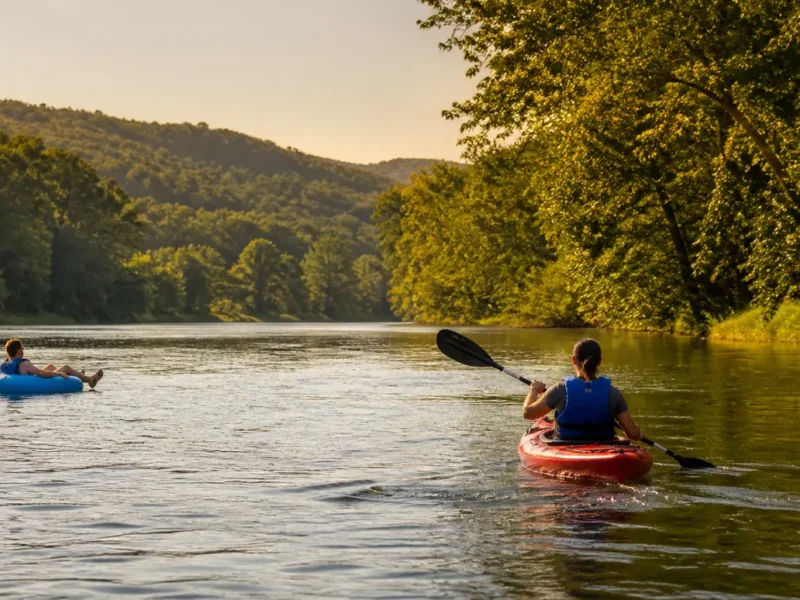
When the water warms and the level eases, the Chestatee becomes the North Georgia float it is known for. Through the summer months the run near Dahlonega fills with tubes and kayaks on warm weekends: gentle riffles and long calm pools, with enough current to keep you moving without working for it. A typical float lasts a few hours depending on the stretch and the put-in, which is why the tubing and kayaking guide matters more than guesswork. The takeout you pick determines your day.
Two habits separate good summer days from mediocre ones. First, go early or go on a weekday, because the popular put-ins get busy by late morning in July. Second, treat the season as water-dependent, not date-dependent: outfitters run when the level and the weather cooperate, and a rainy June can push the best floating into July. Hot-weather weekends are also prime time for gold panning stops and swimming holes, and for the full slate of things to do along the river.
Fall: color, clear water, and trout season again
Ask river regulars their favorite month and most will say October. The water clears and drops, the maples and hickories along the banks turn, and daytime temperatures settle into the best range of the year for being outside in North Georgia. Floating continues while the weather holds, and the fishing picks up noticeably: Georgia DNR stocks the delayed-harvest stretch at Wimpy Mill Road for the cooler months, and catch-and-release rules there protect the fishery through the season. DNR sets the exact dates and rules each year, so confirm current regulations before you wet a line.
Fall is also when the valley is busiest on weekends. Leaf season pulls day-trippers up from Atlanta and the northern suburbs, and the same stretch that felt private in January has company in mid-October. The trade is fair: the river at its clearest, under color, in shirtsleeve weather. If you want both the color and the quiet, aim for a weekday.
What river life looks like day to day
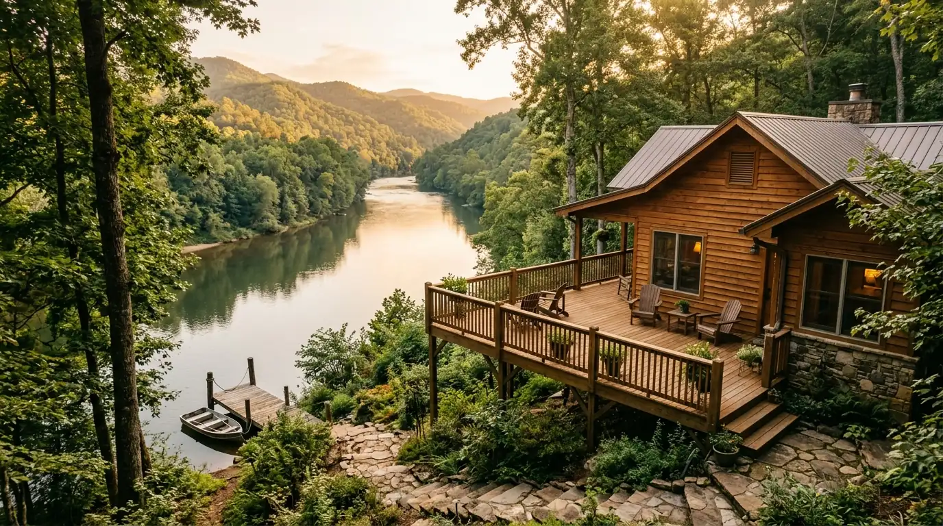
Living on the Chestatee is less about dramatic river days and more about a rhythm. Mornings start with coffee and a glance at the gauge, because high water changes your commute, your dog walk, and your weekend in one stroke. Decks and fire pits face the water, not the road. Weekend plans sort themselves by season: floating and panning in summer, fishing and color drives in fall, quiet walks in winter, and the whole cycle starting over in spring. If you are weighing it against other Dahlonega-area options, the guide to homes and river life covers what daily living actually involves.
One practical note for cabin dreamers: riverside homes here are often wood-sided, and wood near water works for a living. Plan for exterior refinishing, sealing, and restaining — typically $3,000-$8,000 every 3-5 years depending on exposure and finish. The view is worth the upkeep, but the upkeep is real, and it belongs in any honest budget for a place on the water.
Where the river runs
The Chestatee rises in the mountains north of Dahlonega and runs south through the heart of Lumpkin County, past the town, past the valley communities that grew up along its banks, and on toward the headwaters of Lake Lanier. Along the way it picks up the character of each stretch: the historic gold country around Dahlonega, where America’s first major gold rush began in 1829, and the golf-country stretch at Achasta, where the Jack Nicklaus Signature 18-hole course runs alongside the river it shares a valley with. The access points and map guide lays out where you can get on the water in each part of the corridor.
Planning your year on the river
If you are scheduling a first visit, match the month to what you want. June through August for floating and swimming weather. October for color and clear water. March and April for spring green and rising fish, with an eye on the gauge. December through February for solitude and the river at its most powerful. Whenever you come, build the plan around water, not dates. The river keeps its own schedule, and it does not check yours.
Frequently Asked Questions
What is the best month to visit the Chestatee River?
October is the favorite of most river regulars: clear, lower water, fall color, and comfortable temperatures. June through August is best if floating and swimming are the goal. There is no unusable month; there are only months that suit different plans.
How do I check Chestatee River water levels before I go?
Read the USGS gauge for the Chestatee near Dahlonega, which reports gauge height and discharge in real time. Outfitters also post advisories when levels are high. Make the gauge a habit; conditions on this river change faster than weather apps suggest.
When is tubing season on the Chestatee?
Tubing runs roughly from early summer into early fall, but the season is water-dependent rather than date-dependent. Outfitters open when the level and temperature cooperate and close when they stop, so confirm with them directly for the current week.
Is the Chestatee River good for fishing year-round?
Fishing is year-round, but the character changes. Winter and early spring favor patient anglers; summer mornings and evenings are productive; and fall brings delayed-harvest season on the Wimpy Mill Road stretch, when Georgia DNR stocking makes the river one of the better trout options in North Georgia. Confirm current DNR regulations and season dates before fishing.
Does the Chestatee River flood?
Like any mountain river, it rises quickly after heavy rain, and winter and spring bring the highest water. Anyone buying property near the river should check the FEMA flood maps for Lumpkin County for the specific parcel rather than relying on a neighbor’s memory of past high water.
Can you swim in the Chestatee River?
People do swim and wade in the warmer months, but this is a moving river with changing levels, not a pool. Swim with a buddy, avoid high water, wear shoes, and treat any swimming hole as conditions-dependent. There are no lifeguards.
Where does the Chestatee River start and end?
It rises in the mountains north of Dahlonega in Lumpkin County and flows south through the Dahlonega area toward the upper Lake Lanier basin, joining the larger Etowah system downstream. Most visitor activity concentrates on the Dahlonega-area stretches.
Is gold panning allowed on the Chestatee year-round?
Gold panning is part of the river’s identity. Dahlonega sits in America’s original gold country, where the first major rush began in 1828, and panning opportunities run through local outfitters and approved sites across most of the year. Nobody can promise you’ll find gold, and where you can pan is site-specific, so go with an outfitter or a permitted area.
What should I check before a first visit to the river?
Three things: the USGS gauge reading, the weather outlook for the mountains north of town (rain upstream affects you even when the sky over Dahlonega is clear), and current outfitter advisories for the activity you have planned.
Is the Chestatee River clean?
The mountain stretches run clear for most of the year, especially in fall and winter, and runoff after storms temporarily clouds any river. For a current, official picture of water quality, Georgia DNR advisories and monitoring are the authoritative source. Treat any informal answer as a snapshot, not a guarantee.
Does the Chestatee River ever freeze?
Moving water this size rarely freezes over completely, but hard cold snaps bring ice along the edges and on the rocks. Even in January the main current usually keeps running, which is part of what makes the winter river worth seeing.
What is it like to live on the Chestatee in winter?
Quiet, cold, and beautiful. The valley empties out after the holidays, the river runs at full voice, and woodstove season runs long. Winter is when river residents get the place to themselves, and when they watch the gauge most carefully.
How far is the Chestatee River from Atlanta?
The Dahlonega stretches sit roughly an hour to an hour and a half north of Atlanta depending on your starting point and the season, which is why warm weekends fill up. It is the closest real mountain-river floating to much of metro Atlanta.
If a year on the water sounds better than a week of it, the river corridor has homes worth a serious look. Explore Dahlonega homes with Gold Peach Realty or call (770) 283-1223.
North Georgia Real Estate
Looking for Homes on the Chestatee River?
Gold Peach Realty are the local experts in Dahlonega and Lumpkin County real estate. Search riverfront properties, mountain cabins, and North Georgia homes.